

AIRBORNE LiDAR
AIRBORNE LiDAR
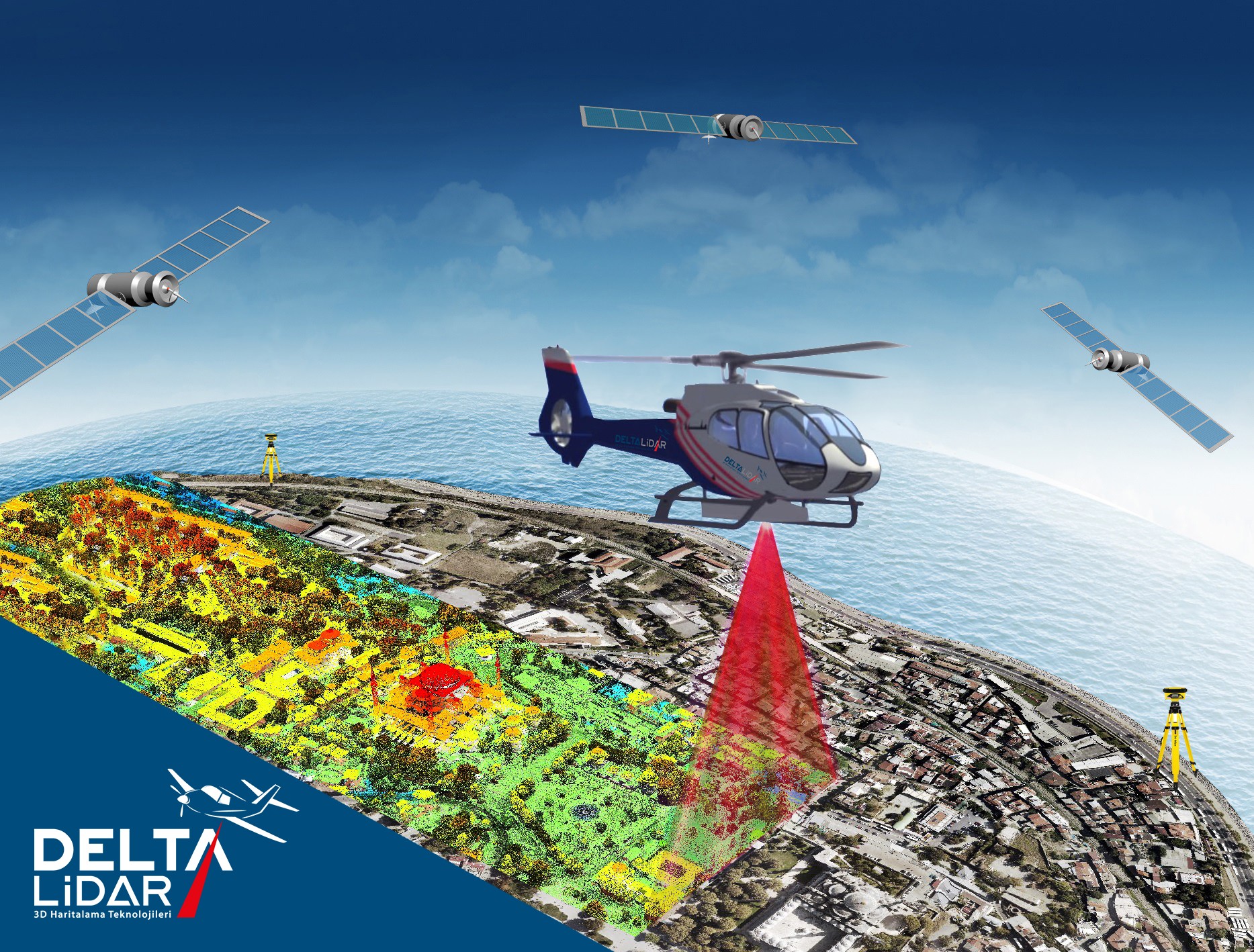
An Airborne Lidar system consists of a laser scanner, an IMU (Inertial Measurement Unit), and a GPS (Global Positioning System that are attached to the air vehicle (helicopter, airplane). This system produces a point cloud containing the X,Y,Z coordinates of the scanned surface or object.
Delta Lidar with its expert Lidar Team (more than 10 years) and up to date Laser Scanning Equipment serves for the sector; agriculture, forestry, air transportation, energy, construction municipality, mining, and transportation.
We develop fast and economic solutions in producing corridor type maps for land survey and planning of projects including pipe lines, power lines, highways, and railways; hydrographic works such as flood disaster analysis; and producing risk maps for natural disasters such as landslides.
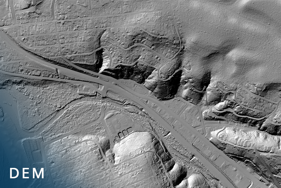
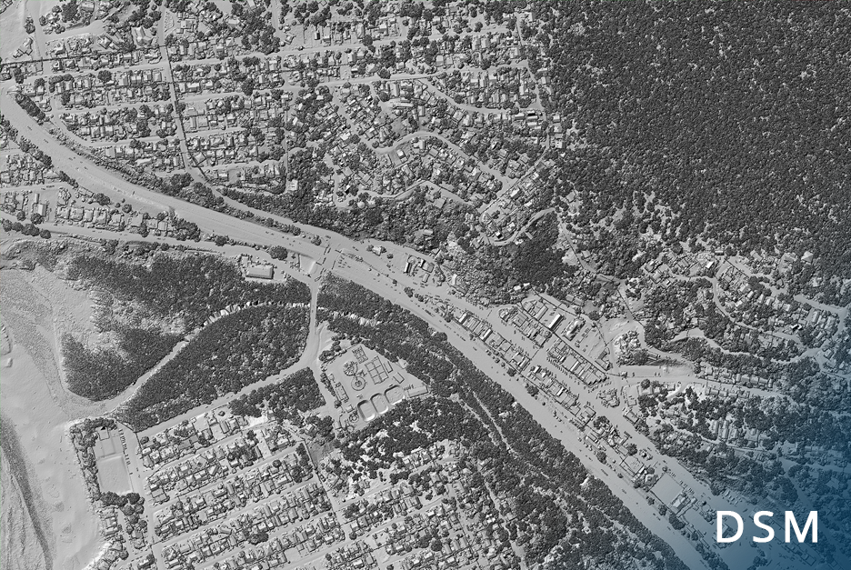
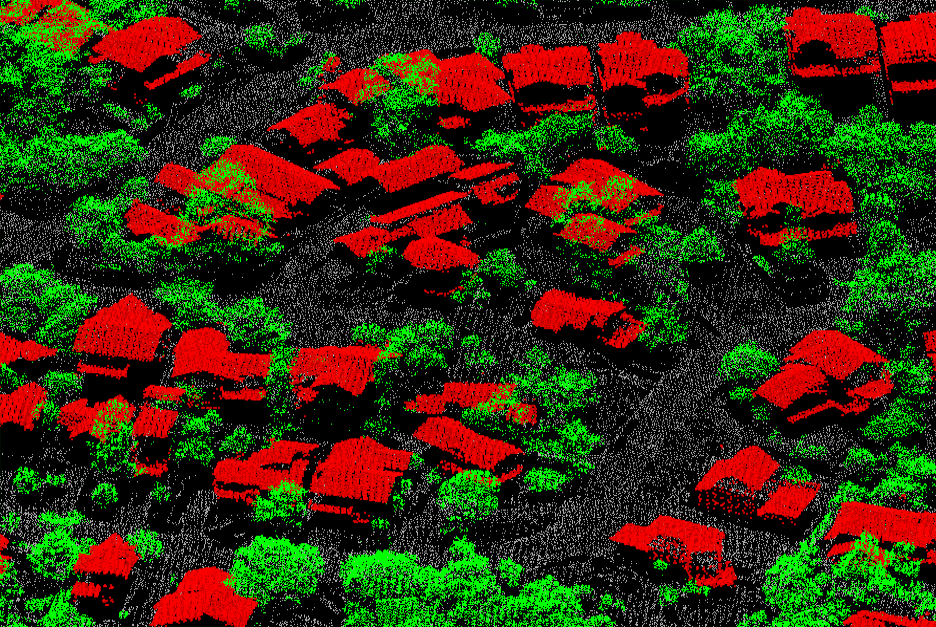
Product Of Airborne Lidar

AIRBORNE LiDAR Service BROCHURE
For detailed information;
you can review our Airborne Lidar BROCHURE.
ADVANTAGES OF AIRBORNE LIDAR APPLICATIONS
Airborne Lidar makes possible to map very wide areas in a short time period and lower cost with no compromise on the accuracy of measurements.
- Time
- Cost
- Accuracy
- Precision
WAVEFORM TECHNOLOGY
Waveform technology in Lidar Systems allows laser pulse to move forward by being shattered after hitting an object. With this specialty, many returns are received from a laser pulse. Laser pulse obtains data not only from tree surface but also from the topography, buildings, power lines etc. beneath the trees and forest in lands occupied with dense forest or other type of flora. DeltaLidar analyzes the waveform data of 3D point cloud generated by the Airborne Lidar system and produces Digital Elevation/ Digital Surface Model of the topography beneath the forest by classifying the point cloud data.
WHERE TO APPLY?
-
MUNICIPAL WORK
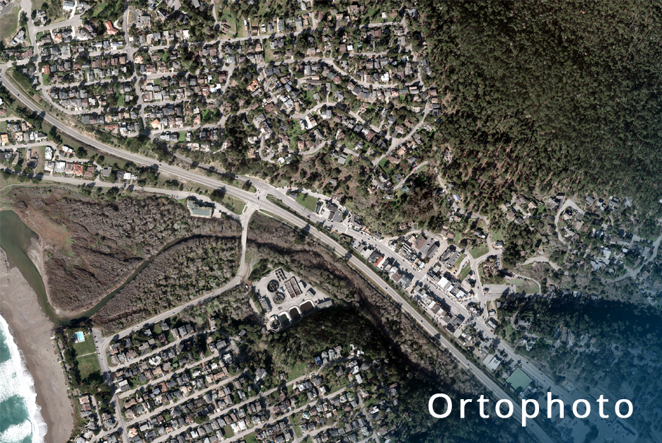
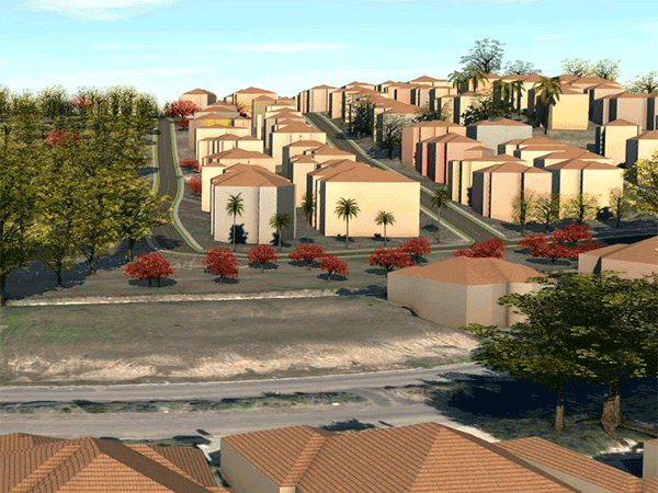
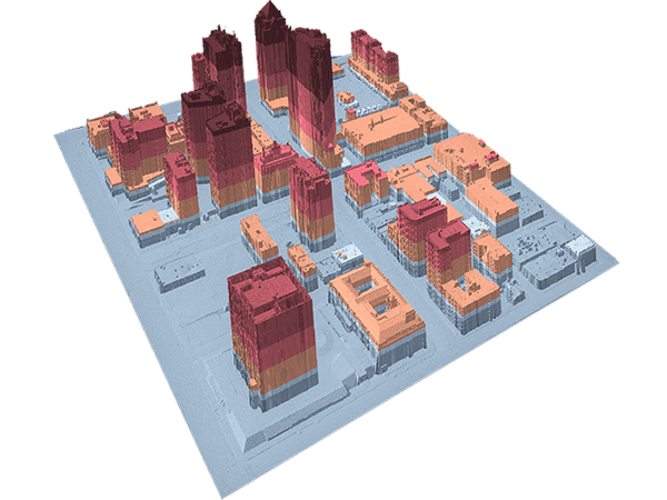
3D City Maps, Analyses of City Silhouette, Change detection analysis, River Reclamation, Flood Hazard Works, Planning, Topography, Solar Energy Potentiality Maps, Infrastructure Projects, Orthophoto.
-
PLANNING
Contour lines, obtained from the Digital Surface and Elevation Models, provide the best base data in urban planning as it reveals the current situation as it is.
-
CONSTRUCTION
Base maps, Sensitive Cubage Calculations, Urban Transformation, Infrastructure projects, Channel Projects, Dam Constructions.
-
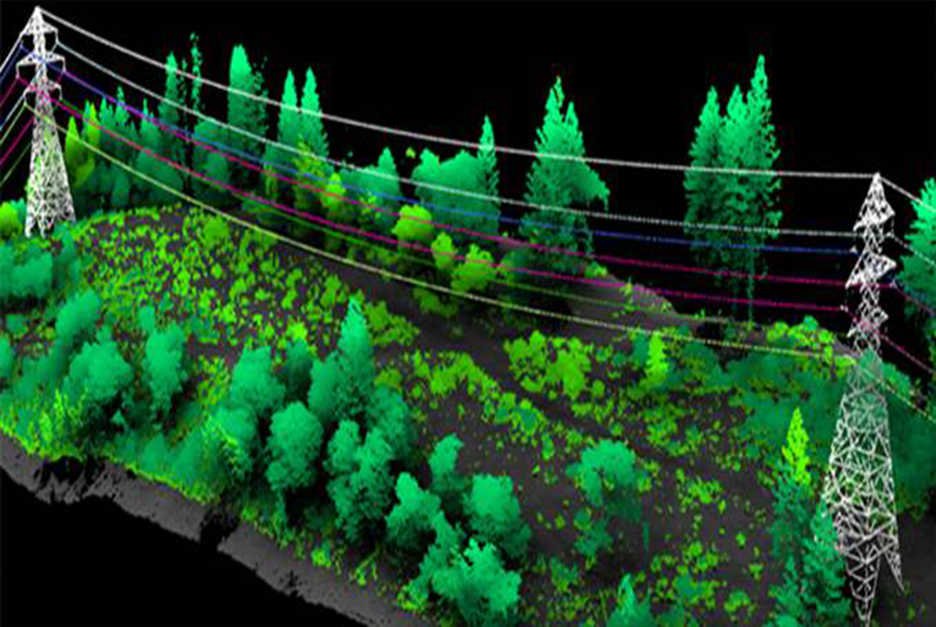
ENERGY
The data obtained from the point cloud is used for the most appropriate location analysis for solar and wind power plants through the clearance analysis and the minimum distance approach analysis. Also, Airborne Lidar data helps to generate energy corridor and solar energy potentiality maps.
-
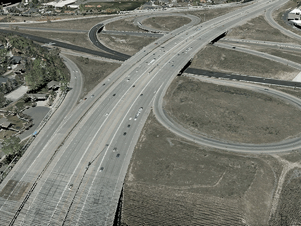
TRANSPORTATION
Airborne Lidar technology is effectively used in corridor mapping of highways, railways, and pipelines. Airborne Lidar data makes possible very detailed analyses through the corridor for transportation planning.
-
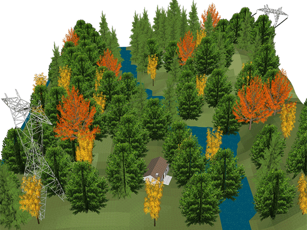
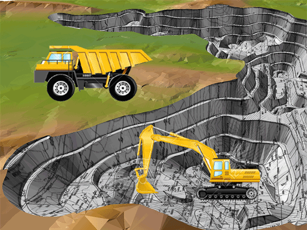
FOREST MANAGEMENT
Information required for stance mapping and the calculation inheritance such as height of a tree, crown diameter of a tree, number of trees can be economically and quickly retrieved from the Airborne Lidar data. In addition, topography beneath a forest can be obtained in detail.
-
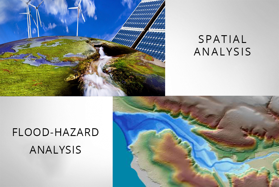
SPATIAL ANALYSIS AND HYDROGRAPHY
Spatial analysis of base stations, nuclear plants, solar plants, wind power plants, bathymetry, coastal management, flood hazard analyses.
-

AIR TRANSPORTATION
Modelling and Determining manias.
-
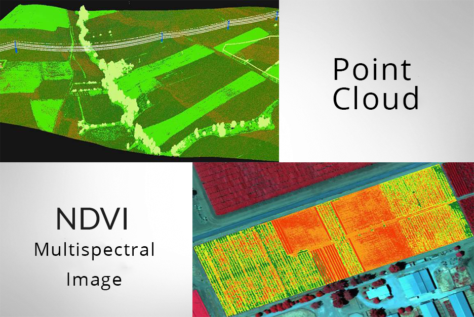
MANAGEMENT OF AGRICULTURAL FIELDS
All the details belong to the topography of agricultural fields are mapped from the Digital Elevation Model generated from the Airborne Lidar System. Details that are difficult to map such as the border lines between fields, small streams beneath the trees and grass, small pathways, irrigation ditches, and holes can be sensitively mapped with the Airborne Lidar System .


 CHANGE DETECTION ANALYSIS
Delta Lidar automatically detects the changes on a land by comparing the data obtained from the same region at different times. Change detection analysis helps to detect;
- Illegal construction of new building or addition of new floors.
- Illegal cutting of trees in forests.
- Illegal burying of construction debris
 FLOOD-HAZARD ANALYSIS
Flood Hazard Analyses produce very accurate outcomes as the Digital Elevation and Digital Surface models obtained from the Airborne Lidar point cloud are the very close representation of the land to the actuality in 3D format.