Don’t just
see your structure
understand and manage It
Delta Lidar not only transfers your physical world into the digital environment but also provides a sustainable management infrastructure. With digital twins, transform your maintenance, planning, and operational processes.
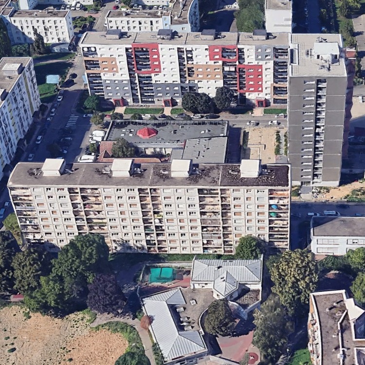
Realistic 3D mapping for digital twin cities
We provide highly accurate 3D modeling solutions using Lidar and photogrammetric methods for smart city development and digital twin infrastructure.
- City-scale, geo-referenced, detailed 3D model production
- Easy analysis with GIS-integrated, layered data structures
- Web-based software for city-scale 3D visualization and analysis
- Data foundation for urban planning, disaster management, and infrastructure optimization
- Direct integration into engineering projects with BIM and CAD-compatible formats
- Sustainable city management through time-based comparisons and change detection analyses
- Infrastructure for digital archiving and visual decision-support systems
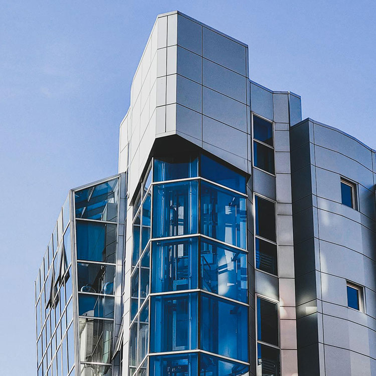
3D modeling of buildings and facilities
We digitize the current state of buildings and industrial facilities using laser scanning technology to create detailed and measurable 3D models.
- Millimeter-accurate interior and exterior scanning
- BIM-compatible model production (Revit, IFC, etc.)
- Data support for facility management and maintenance processes
- Error-free planning in renovation and expansion projects
- Simplified structural analysis for complex buildings
- Infrastructure support for architectural, mechanical, and electrical systems
- Creation of as-built documentation
- Remote access and monitoring with digital twins
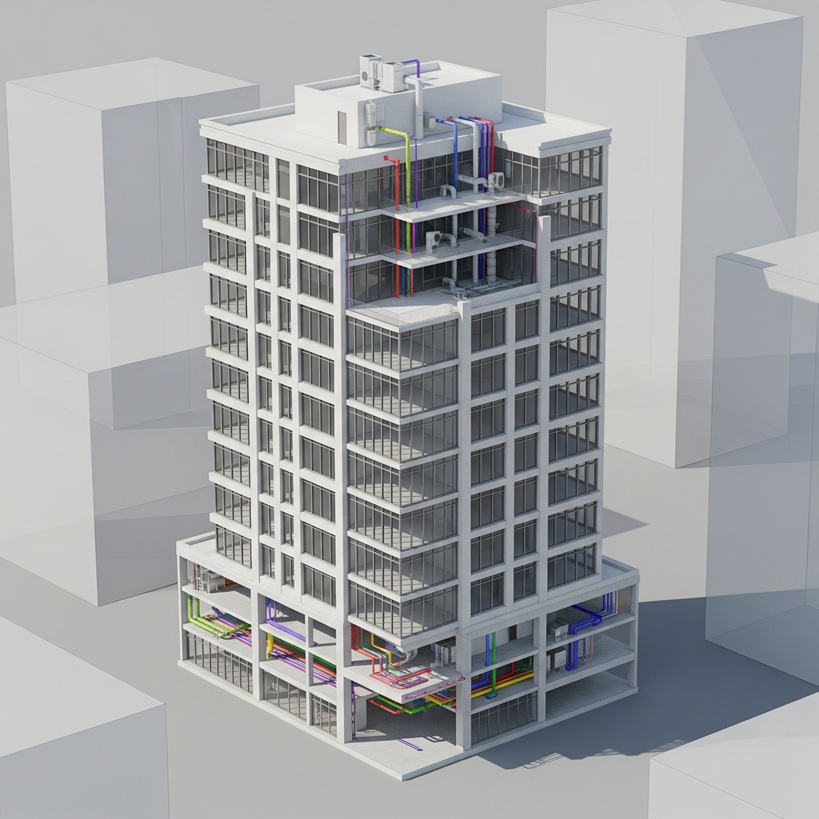
Data production for BIM projects
We generate precise geometric data required for building and infrastructure projects using terrestrial laser scanning and drone technologies, integrating them into BIM processes.
- BIM-compatible model production (IFC, Revit, etc.)
- Millimeter-accurate as-built scanning
- 3D point clouds, mesh, and surface models
- Discipline-specific data for architectural, structural, and MEP (mechanical, electrical, plumbing) systems
- Data infrastructure for renovation and as-built projects
- Planning support that reduces time, cost, and error rates
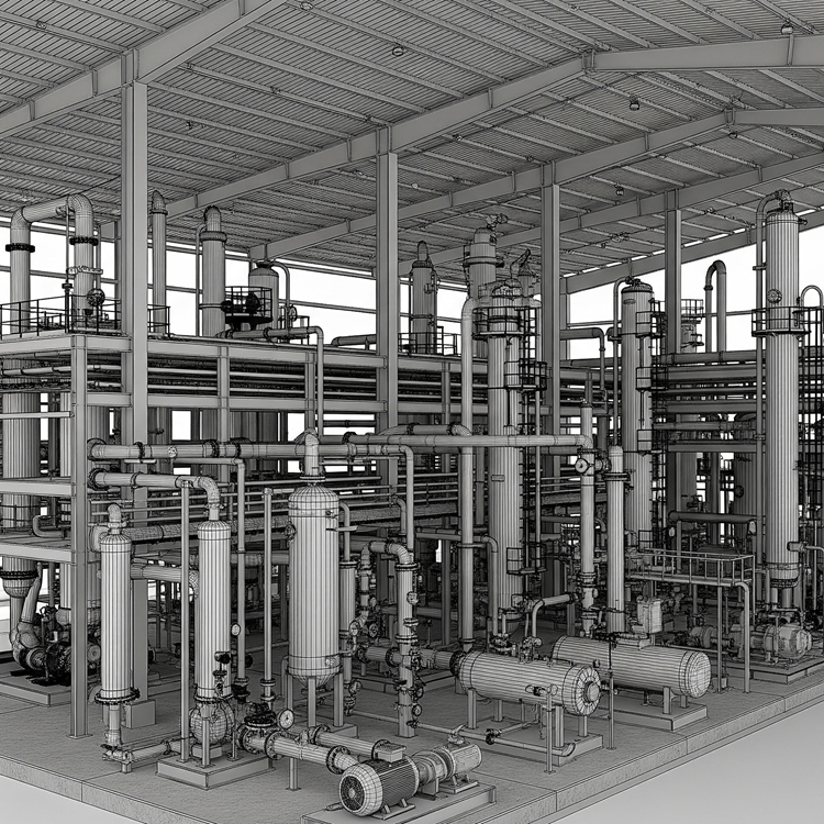
3D modeling of industrial facilities and power plants
We provide high-precision 3D modeling solutions for the digital twin of complex structures and critical infrastructures.
- Contactless laser scanning and photogrammetric measurement technologies that do not disrupt operations
- Fast and secure documentation of current conditions with millimeter accuracy
- CAD- and BIM-compatible data production for project planning and revisions
- Modeling of equipment and piping systems in power plants
- Web-based platforms offering remote 3D visualization and measurement capabilities
- Integrated data infrastructure for process management, safety analyses, and maintenance planning
Advantages of Digital Twin & 3D Modeling
The geometric details, surface properties, and spatial relationships of structures are fully digitized. We provide models that can be integrated with BIM software for use in construction, engineering, and facility management processes. With digital twins, structural changes, deformations, and maintenance needs can be continuously monitored.

Millimeter-Accurate 3D Models
GIS- and BIM-Compatible Data Structure
Real-Time Monitoring and Analysis

High Precision
Let’s Plan Your Project Together
Let’s design the most suitable 3D modelling solution for your project together!
At Delta Lidar, we evaluate the entire process with you—from your terrain characteristics to your data density requirements, from technological infrastructure to delivery timelines—and create a customized application model tailored to your needs.