Reduce risks,
increase efficiency
with spatial data!
At Delta Lidar, we make your projects more predictable and sustainable with our spatial analysis solutions. Meet our expert team for data-driven, map-based decision-making.
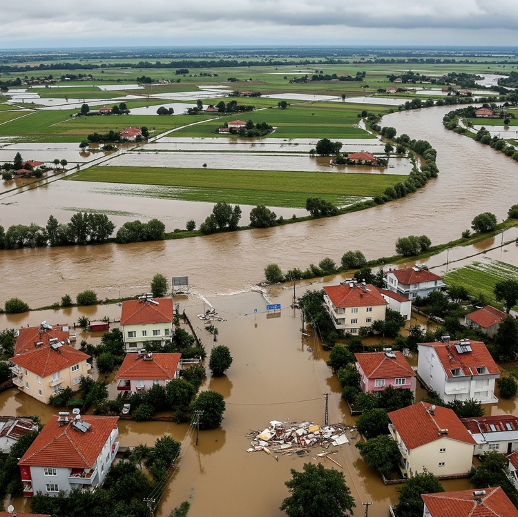
Flood hazard and risk analysis
For disaster management, urban planning, and infrastructure safety, we provide flood and inundation risk analysis solutions using high-resolution LiDAR data, supported by scientific consulting from expert academics.
- High-accuracy surface and terrain model generation (DSM/DTM)
- Detailed analysis of flow direction, catchments, and water accumulation areas
- Flood propagation simulations and hazard zone mapping
- Precise impact analyses for critical infrastructures
- Risk assessment and scenario generation based on geospatial data
- Dynamic modeling infrastructure integrated with climate data
- GIS-based data production and compatibility with decision support systems
- Scientific consulting from specialized academics
Landslide hazard and risk analyses
With high-resolution LiDAR data and academic consulting support, we provide comprehensive landslide inventory, hazard, and risk analysis solutions for disaster management, land-use planning, and infrastructure safety. High-accuracy surface and terrain model generation (DSM/DTM)
- Detailed slope morphology and gradient analysis
- Classification of landslide-prone areas
- Detection and monitoring of surface deformations
- Impact analysis and safety zoning for critical infrastructures
- Integrated modeling with soil type, vegetation, and rainfall data
- Data support for early warning systems in high-risk areas
- GIS-based mapping and decision-support outputs
- Technical content aligned with municipalities, geological engineers, and public institutions
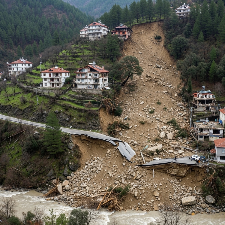
Rockfall hazard and risk analysis
To mitigate rockfall hazards, we offer specialized solutions for land-use planning and disaster management through LiDAR-based data analyses and academic collaborations.
- High-accuracy surface and terrain model generation (DSM/DTM)
- Detailed morphological analysis of steep slopes and high-gradient areas
- Identification of rock block location, volume, and potential movement paths
- Creation of hazard zones and mapping of high-risk areas
- Vulnerability assessments for infrastructure and settlement areas
- Parametric simulations developed with academic consulting
- GIS-compatible data production and visual reporting infrastructure
- Tailored solutions for highways, railways, and mountainous settlements

What do we offer?
We develop customized analysis models tailored to the needs of public and private sector projects. We create map-supported solutions that visualize complex data, perform analyses, and simplify decision-making.
Let’s Plan Your Project Together
Let’s design the most suitable mapping solution for your project together!
At Delta Lidar, we evaluate the entire process with you—from your terrain characteristics to your data density requirements, from technological infrastructure to delivery timelines—and create a customized application model tailored to your needs.