By scanning vast and hard-to-access forested areas from the air, we provide critical data such as tree density, height, and species identification.
Through digital data, we help protect ecosystems and contribute to the sustainability of forest resources.

Forest Inventory & Species Identification
We provide data-driven insights into your forest resources — from tree species to density maps — supporting sustainable management strategies.
- Tree height, crown diameter, volume, and biomass measurement with LiDAR data
- Tree species classification using multispectral cameras
- Species-based density and distribution maps
- Planning of forest roads, firebreaks, and access routes
- Forest change analysis
Tree Health and Stress Detection
We contribute to maintaining a productive and healthy forest ecosystem through advanced vegetation health analyses.
- Creation of vegetation health indices (NDVI, NDRE) with multispectral analysis
- Early detection of drying, disease, and insect damage
- Canopy volume reduction and leaf density decline analysis with LiDAR
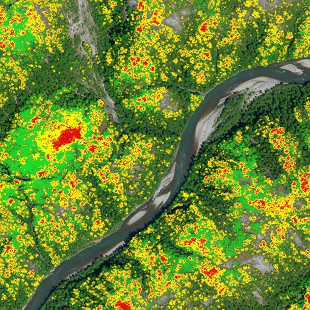
Forest Fire Risk Analysis
We identify high-risk areas in advance and generate detailed fire risk maps.
- Fuel load mapping with LiDAR (deadwood, shrub density)
- Drought and moisture status detection using multispectral data
- Accurate spatial data production for pre-fire, active fire, and emergency response planning
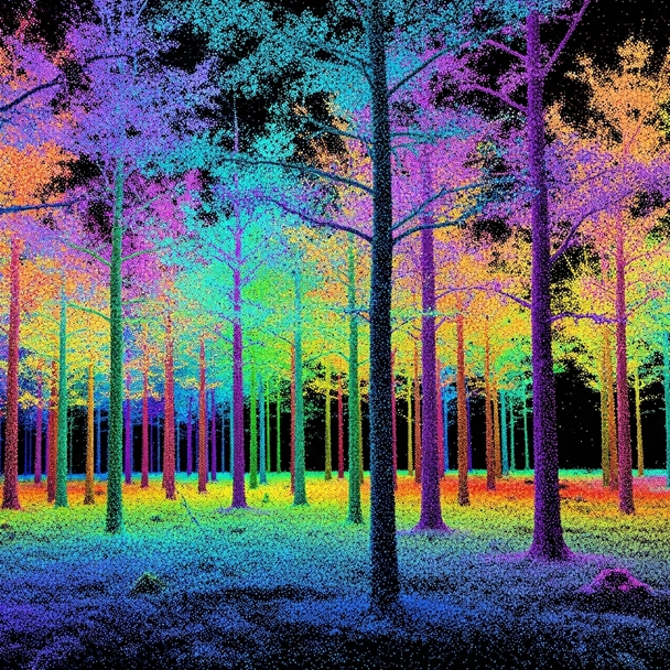
Tree and Trunk Measurements with Lidar
We provide complete and reliable inventory solutions by scanning each tree individually.
- Trunk diameter, trunk volume, crown structure, and tree height measurements with terrestrial and handheld LiDAR
- Species based tree counting and distribution maps
- Accurate planning of roads and logging areas

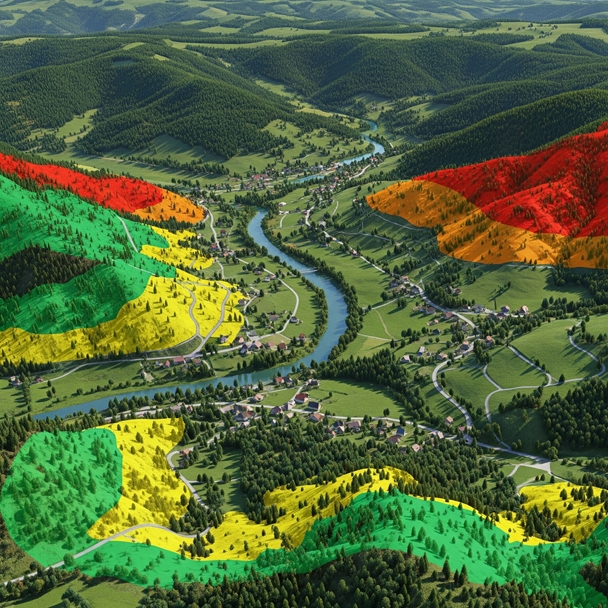
Habitat & biodiversity monitoring
Detect environmental threats such as forest fires, erosion, and illegal logging at an early stage and take rapid action.
Monitoring of protected areas
Species diversity maps

Biomass measurement
Change analysis
Forest management focused on conservation and sustainability is now possible.
With our advanced LiDAR systems, we analyze the physical structure of trees, their spatial distribution, and their area-based changes in detail.
We map vegetation, terrain structure, and topographic features in detail
By integrating physical factors such as slope, elevation, and density in forested areas, we support long-term planning.
Protect natural resources and anticipate threats with data driven forest management!

Forest Inventory Production

Fire and Erosion Risk Detection
