Turn the
invisible into insight illuminate your decisions with your data
Delta Lidar makes the unseen visible. With our spectral and thermal mapping technologies, detect changes in the field on time, quantify plant health, identify risks in power transmission lines early, and use your resources efficiently.
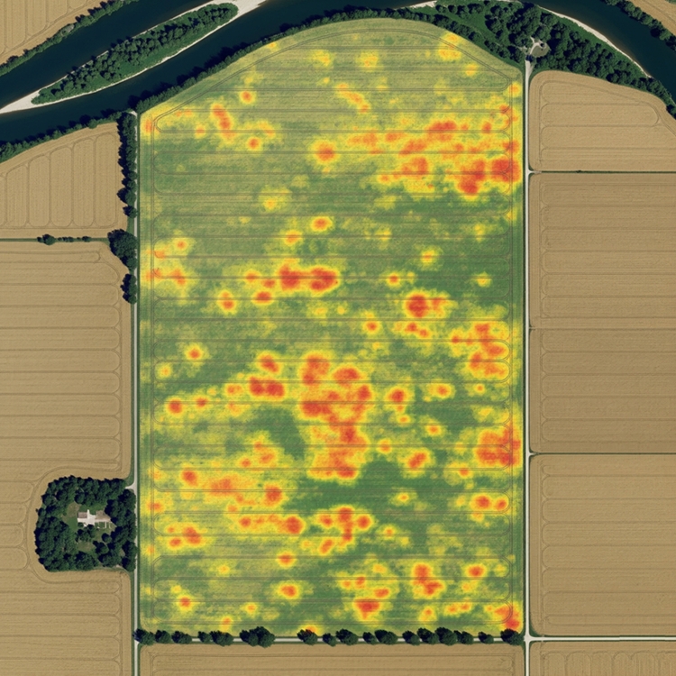
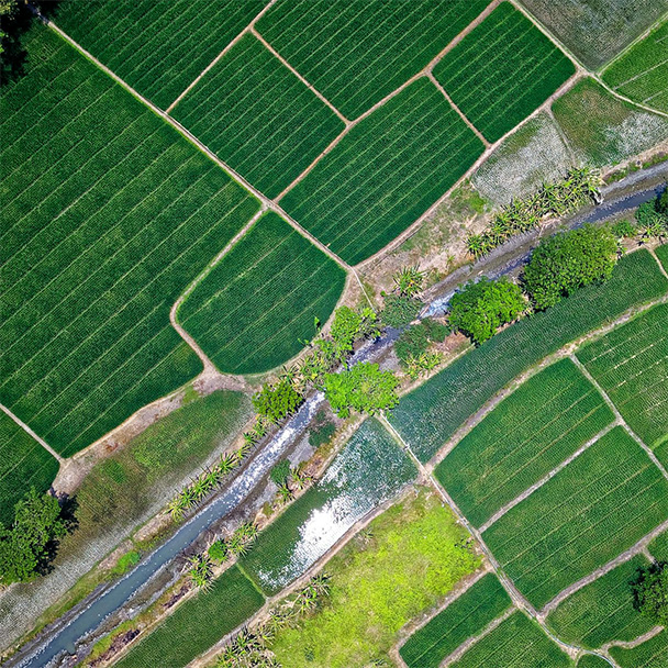
Precision agriculture applications
Delta Lidar provides multispectral imaging technology to analyze plant health, stress levels, and yield potential in agricultural fields.
- Plant health detection (using indices such as NDVI, NDRE)
- Early identification of stressed or diseased areas
- Regional fertilization and spraying planning
- Regional determination of irrigation needs
- Crop growth monitoring and harvest time planning
- Resource savings with in-field variability maps
- Long-term monitoring of plant performance
- Data integration with agricultural machinery
Soil moisture analysis and irrigation
With multispectral imaging and sensor-supported data analysis, we precisely measure soil moisture levels in agricultural fields to optimize irrigation processes.
- Region-based soil moisture maps
- Prevention of over- or under-irrigation
- Moisture analysis correlated with plant growth
- Data integration with automated or smart irrigation systems
- Low cost, high efficiency
- Sustainable irrigation planning with long-term monitoring
Rehabilitation and land restoration
Delta Lidar provides data-driven solutions for rehabilitation and restoration processes in mining sites, degraded natural areas, and lands affected by human intervention.
- High-precision topographic mapping of degraded areas
- Before-and-after comparative analyses
- Assessment of vegetation and soil structure
- Erosion and water flow risk maps
- Monitoring and reporting of restoration success
- Long-term environmental monitoring
- GIS-based visualization and planning support
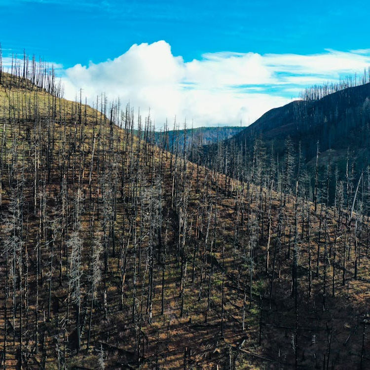
Forestry and environmental monitoring
We integrate Lidar and drone technologies for forest management, tree inventory, biomass calculations, and monitoring of environmental changes.
- Tree counting and volume measurements
- Species density and distribution mapping
- Detection of forest roads and clearings
- Biomass and carbon stock calculations
- Post-forest fire damage assessment
- Monitoring of erosion and landslides
- Tracking of wildlife habitats
- Long-term environmental change analyses
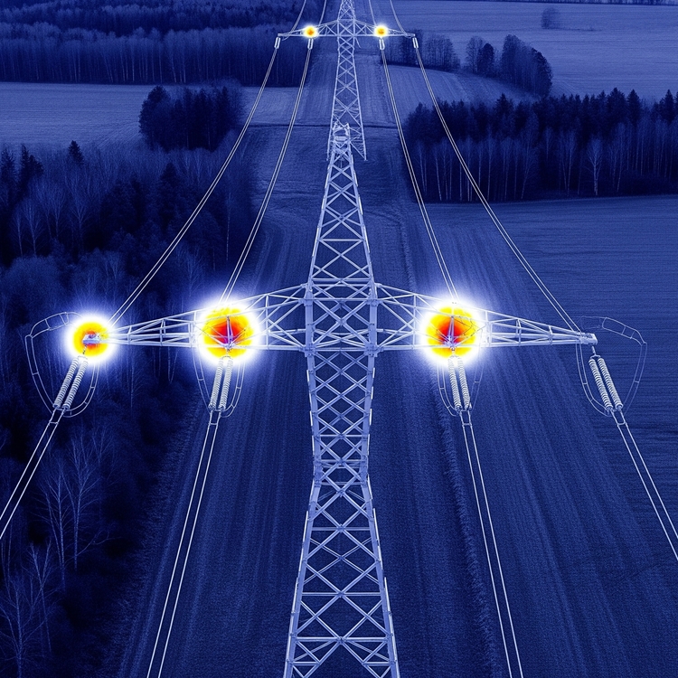
Thermal mapping
Delta Lidar provides data-driven solutions for early diagnosis, risk analysis, and maintenance planning in power transmission lines through thermal mapping technology. Thermal mapping also offers solutions across various sectors, including industrial facilities, agricultural areas, urban infrastructure, and disaster management.
- Detection of overheated connection points
- Thermal performance analysis of equipment along transmission lines
- Fault and energy loss risk maps
- Support for preventive maintenance and planning
- Heat loss mapping in buildings (energy efficiency analysis)
- Spatial identification of the heat island effect
- GIS-based thermal map visualization for decision support
Advantages of spectral mapping
With spectral and thermal data, we can detect plant stress early and analyze disease and irrigation needs in advance. Contactless, high-resolution data is obtained over agricultural fields, forested areas, and large terrains. Through area-based analysis, fertilization, spraying, and irrigation practices are optimized to maximize efficiency. At the same time, thermal imaging enables the early detection of faults in power transmission lines—such as electricity leakage, overheating, and damaged insulators—allowing maintenance and intervention processes to be managed effectively.
Plant Health Monitoring
Thermal Imaging

Targeted Intervention

High Precision
Let’s Plan Your Project Together
Let’s design the most suitable Spectral Mapping solution for your project together!
At Delta Lidar, we evaluate the entire process with you—from your terrain characteristics to your data density requirements, from technological infrastructure to delivery timelines—and create a customized application model tailored to your needs.