At Delta Lidar, we complete your projects on time and with precision through our advanced terrestrial Lidar systems and expert team. Whether it’s the restoration of a historical building or the modeling of an industrial site – we are here to ensure you reach the right data.
See the reality beneath the surface with terrestrial laser scanning precise, millimeter scale, pinpoint accurate data!
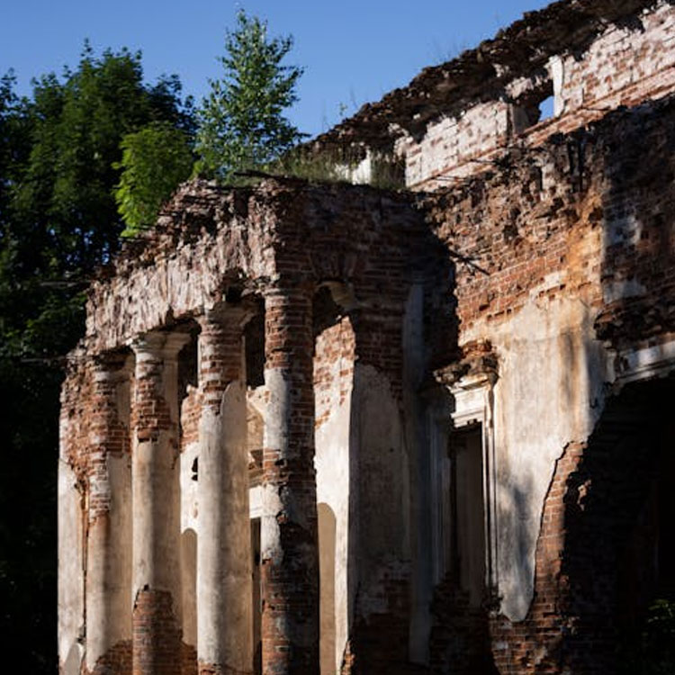
Architectural restoration and preservation
We use terrestrial laser scanning technology to generate data for the preservation and restoration of historical buildings. Without altering the existing condition of the structures, we provide detailed digital documentation and create highly accurate 3D models that serve as a foundation for the restoration process.
- Contactless and non-destructive data collection
- Millimetric measurement accuracy
- Section and elevation images (orthoimages) for CAD drawings
- Comprehensive structural deformation analysis
- Archivable digital data production
- Direct integration with CAD and BIM systems
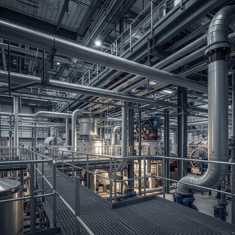
Factory and facility scanning
Delta Lidar provides high-accuracy terrestrial laser scanning solutions for factories and industrial facilities. By rapidly and precisely scanning complex structures such as production lines, piping systems, platforms, storage areas, and mechanical installations, point clouds and 3D models are generated for detailed CAD drawings.
- Millimetric precision in dense equipment and confined spaces
- Documentation of piping, cabling, and equipment installations
- Analysis of renovation, expansion, and modernization projects
- Data compatible with CAD, BIM, and Digital Twin systems
- Visual and measurable contributions to occupational health and safety
- Digital archiving for facility management
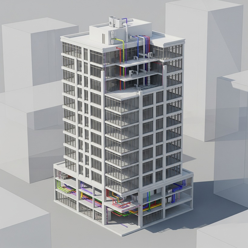
3D building modeling (BIM-Compatible)
Delta Lidar produces complete, true-to-reality 3D models by scanning the interiors and exteriors of existing buildings with millimetric precision. This provides a flawless foundation for interior design, facility management, and as-built projects.
- Millimeter-accurate interior modeling faithful to real conditions
- Infrastructure for facility management and renovation projects
- BIM-compatible data production (IFC, Revit, etc.)
- Support for architectural, electrical, and mechanical system planning
- Fast and safe measurements for complex structures
- Accurate modeling of floor, wall, and ceiling relationships
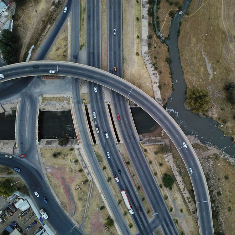
Tunnel, bridge, and infrastructure scanning
We provide high-precision terrestrial laser scanning solutions for safety, maintenance, and engineering analyses in infrastructure projects. Detailed 3D models of complex structures such as tunnel interiors, bridge superstructures, culverts, retaining walls, and underground passages are generated, enabling current condition assessments and structural deformation monitoring.
- High-accuracy scanning in narrow and complex areas
- Change detection and analysis over time
- Comparative analysis before and after construction
- Full compatibility with GIS, CAD, and BIM systems
- Data support for logistics and maintenance planning
- Long-term digital archiving capabilities
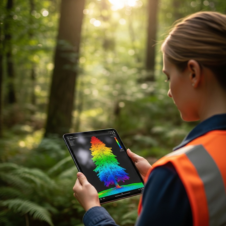
Tree survey (trunk and crown diameter, location)
Using terrestrial laser scanning technology, Delta Lidar measures tree trunk diameters, crown diameters, and precise location data with millimetric accuracy. This provides reliable and detailed information for urban green space management, landscaping projects, environmental impact analyses, and forest inventory studies.
- Trunk and crown diameter measurements
- 3D determination of tree locations
- Urban forest and green space inventory
- Support for landscaping and environmental planning
- Base maps, topographic drawings, and GIS integration
- Web-based visualization
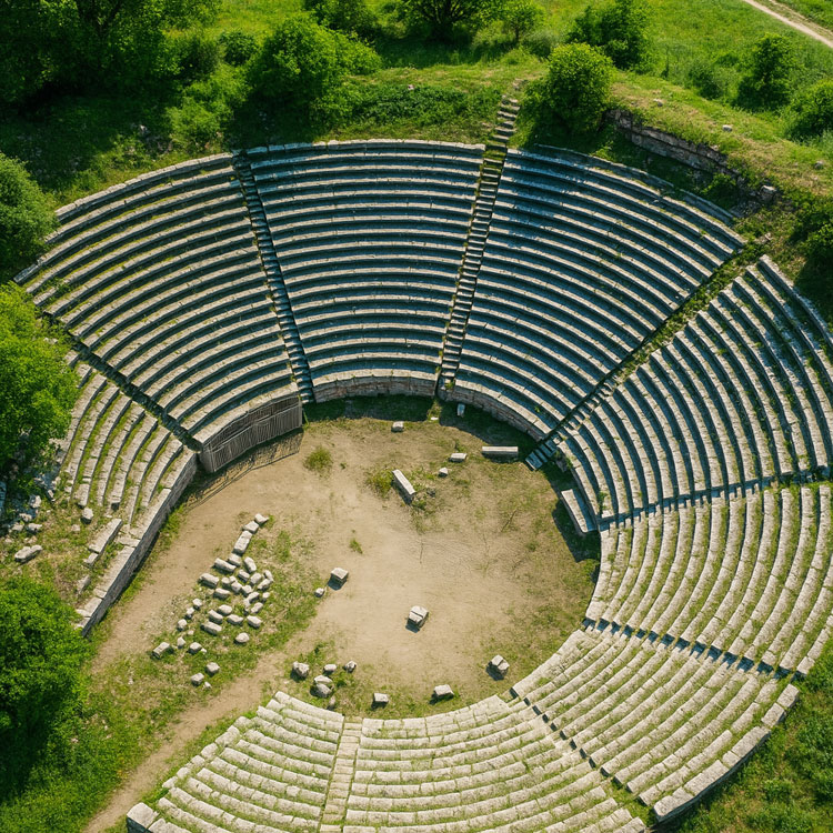
Archaeological site documentation
In archaeological excavation and conservation projects, Delta Lidar provides high-accuracy terrestrial laser scanning services without causing any damage to the sites. With precise 3D documentation, cultural heritage is digitally recorded, creating a secure foundation for scientific analyses.
- Contactless and non-destructive scanning
- Millimetric 3D modeling
- Pre- and post-excavation comparisons
- Data support for academic analyses
- Long-term digital archiving
- Visualization and virtual exhibition opportunities
Advantages of terrestrial laser scanning
With the terrestrial laser scanning method, we capture historical buildings, industrial facilities, and urban details in 3D with millimetric precision—quickly and without compromising accuracy. Compared to other methods, terrestrial laser scanning offers the following advantages:
Time

Cost

Accurate Results

Precision
Let’s Plan Your Project Together
Let’s design the most suitable Laser Scanning solution for your project together!
At Delta Lidar, we evaluate the entire process with you—from your terrain characteristics to your data density requirements, from technological infrastructure to delivery timelines—and create a customized application model tailored to your needs.