Meet the Delta Lidar software team. Let’s develop map-based systems, analysis panels, and data processing tools tailored to your projects.
Let’s turn your maps, data, and ideas into powerful software.
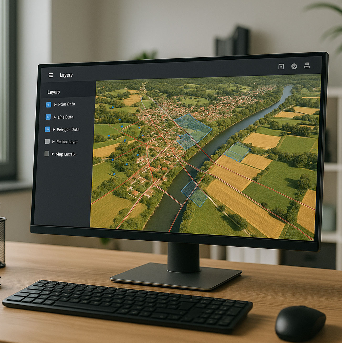
ESRI GIS software
As an ESRI partner, we develop industry-specific map-based web applications and provide sales, installation, and integration services for ESRI GIS products.
- Interactive map interfaces
- Data layer management
- Customizable dashboards and reporting
- Real-time updates
- GIS and API integration
- High performance, robust infrastructure
- Artificial intelligence

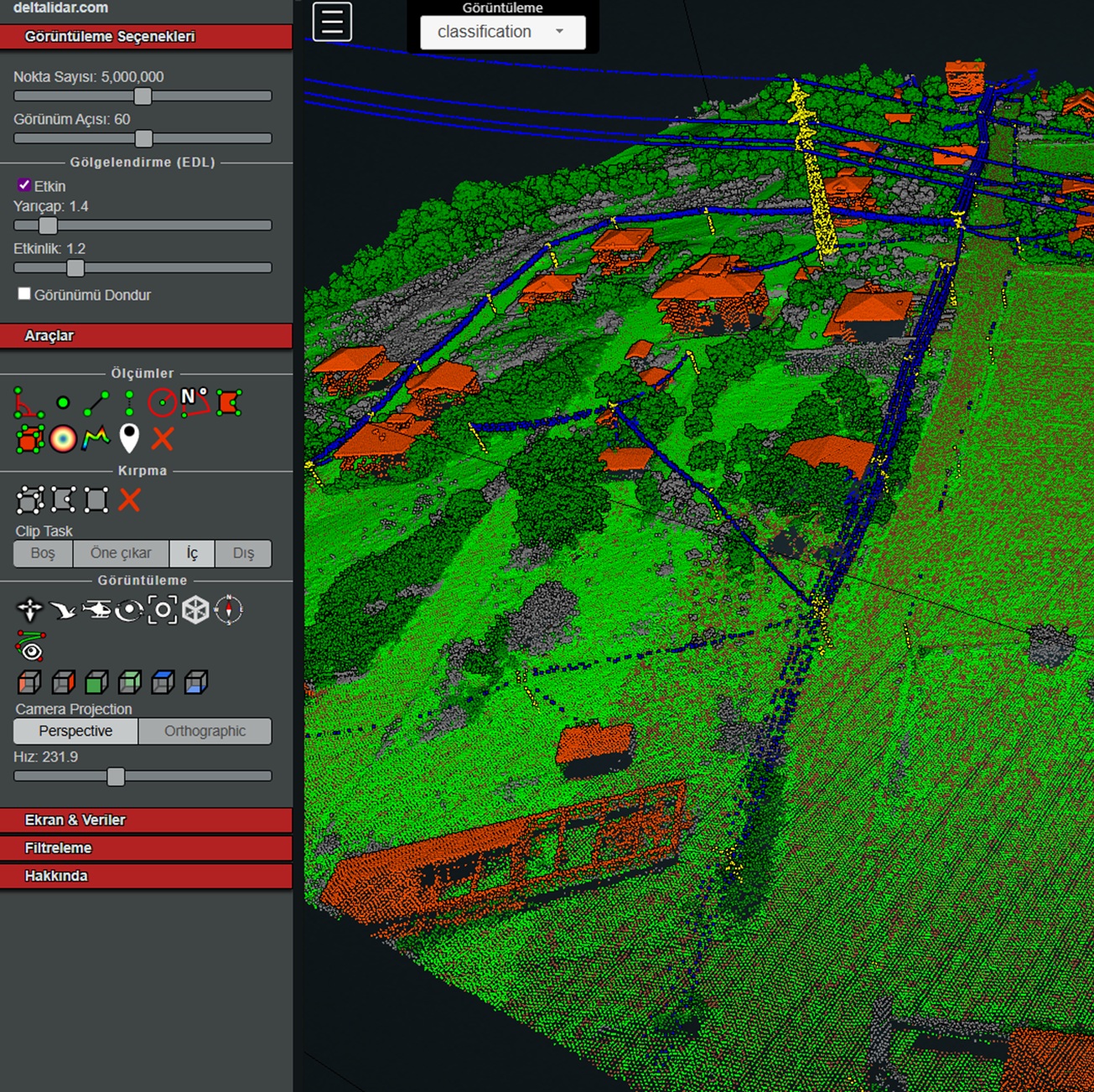
Lidar point cloud software
We provide customized software solutions to view and analyze LiDAR data with high performance via the web. With our web-based software solutions, clients using our LiDAR mapping services can easily access point cloud and 3D model data, perform analyses, and accelerate their workflows.
- Interactive 3D point cloud visualization
- Data layer and filtering management
- Cross-section and elevation profile analyses
- Measurement tools (distance, area, volume calculations)
- Image capture (Orthoimage & 3D perspective)
- Data export to CAD and GIS environments
- High performance, robust infrastructure
3D model software
We provide customized software solutions to visualize and analyze 3D modeling data with high performance via the web. With our web-based software, clients using our 3D modeling services can easily access and analyze digital twin, mesh model, and 3D data.
- GIS integration compatible with existing corporate systems Interactive
- 3D model visualization from building scale to city scale
- Measurement tools (distance, area, volume calculations)
- GIS and API integration
- Data querying via map interface
- High performance, robust infrastructure
Digital transformation with Delta Lidar
For institutions aiming to accelerate data-driven decision-making processes and maximize the value of field data, Delta Lidar software solutions build the digital bridge between the field and the office.
Let’s Plan Your Project Together
Let’s design the most GIS and mapping software solution for your project together!
As Delta Lidar, we evaluate the entire process together, from your geographic data needs to your system integration processes, from your existing GIS infrastructure to your data management strategy, and create the most suitable GIS application model for you.